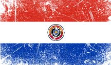
Facts About Paraguay
- Country Telephone Code: 595
- Country Capital: Asunción
- National Currency: Guaraní
- Independence Day: May 14/15, 1811
- Tourism Web Site: Senatur
Geography
- Longitude & Latitude: 23°00 S, 58°00 W.
- Land boundaries: 3,995 km
- Argentina: 1,880 km
- Brazil: 1,365 km
- Bolivia: 750 km
- Land Area: 157,047 square miles (406,752 sq km)
- Highest Point: Cerro Pero at 2,762 feet (842 m)
- Lowest Point: Junction of the Rio Paraguay and the Rio Parana at 150 feet (46 m)
- Political Map: Paraguay consists of the capital district of Asunción, in addition to 17 departments (capitals): Alto Paraguay (Fuerte Olimpo), Alto Paraná (Ciudad del Este), Amambay (Pedro Juan Caballero), Boquerón (Filadelfia), Caaguazú (Coronel Oviedo), Caazapá (Caazapá), Canindeyú (Salto del Guairá), Central (Areguá), Concepción (Concepción), Cordillera (Caacupé), Itapúa (Encarnación), Guairá (Villarrica), Misiones (San Juan Bautista), Ñeembucú (Pilar), Paraguarí (Paraguarí), Presidente Hayes (Villa Hayes) and San Pedro (San Pedro). These departments are divided into 223 districts.
