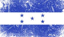
Maps of Honduras
We've added the following Google maps to help you get around Honduras.
The first map is that of the country in its entirety, the remaining maps are catagorized alphabetically by department: Atlántida - Bay Islands - Choluteca - Colón - Comayagua - Copán - Cortés - El Paraíso - Francisco Morazán - Gracias a Dios - Intibucá - La Paz - Lempira - Ocotepeque - Olancho - Santa Barbara - Valle - Yoro.
Country Map
Atlántida
Bay Islands
- Bay Islands Department
- Cayos Cochinos
- Guanaja
- Roatán
- Roatán Juan Manuel Galvez International Airport
- Utila
Choluteca
Colón
Comayagua
Copán
Cortés
- Cortés Department
- Lago de Yajoa
- Puerto Cortés
- San Francisco de Yojoa
- San Pedro Sula
- San Pedro Sula Ramón Villeda Morales International Airport
