Puntarenas Province
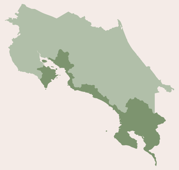
The province of Puntarenas (see map), which includes Caño Island, Cocos Island and several other islands scattered across the Gulf of Nicoya, shares a border with the Alajuela, Guanacaste, Limon and San Jose provinces, and borders Panama to the south. The province is split into two distinct parts, with a small section residing on the Nicoya Peninsula just below the Guanacaste province, and another, larger section running north/south along the Pacific coast.
The capital of Puntarenas is the city of Puntarenas, and the province is divided into 11 regions (cantons), which we have listed from north to south. Click on the text links below for accommodations in each region.
Regions: Puntarenas - Montes de Oro - Esparza - Garabito - Parrita - Quepos - Osa - Golfito - Buenos Aires - Coto Brus - Corredores
Puntarenas
Playa Manzanillo
Google Map - Playa Manzanillo
Playa Hermosa
Google Map - Playa Hermosa
Playa Santa Teresa
Google Map - Playa Santa Teresa
Playa Carmen
Google Map - Playa Carmen
Playa Mal Pais
Google Map - Playa Mal Pais
Playa Cabuya
Google Map - Playa Cabuya
Montezuma
Google Map - Montezuma
Tango Mar
Google Map - Tango Mar
Playa Tambor
Google Map - Playa Tambor
Paquera
Google Map - Paquera
Puntarenas
Google Map - Puntarenas
Monteverde
Google Map - Monteverde
Santa Elena - a small, quaint mountain community that you'll pass en route to the Monteverde Cloud Forest.
Google Map - Santa Elena
Montes de Oro
Miramar - inland
Google Map - Miramar
Esparza
Esparza - inland
Google Map - Esparza
Garabito
Tarcoles
Google Map - Tarcoles
Playa Herradura
Google Map - Playa Herradura
Playa Jacó
Google Map - Playa Jacó
Playa Hermosa
Google Map - Playa Hermosa
Parrita
Playa Esterillos Oeste
Google Map - Playa Esterillos
Playa Esterillos Este
Google Map - Playa Esterillos
Playa Bejuco
Google Map - Playa Bejuco
Parrita
Google Map - Parrita
Playa Palo Seco
Google Map - Playa Palo Seco
Quepos
Quepos
Google Map - Quepos
Manuel Antonio
Google Map - Manuel Antonio
Matapalo
Google Map - Matapalo
Playa Savegre
Google Map - Playa Savegre
Osa
Dominical
Google Map - Dominical
Playa/Punta Uvita
Google Map - Playa/Punta Uvita
The following hotels are scattered along the coast and hillside, where there are several small beaches. Knows as the Bellena Coast, it's where you also find the Marino Ballena National Marine Park. The beaches include Hermosa, Uvita, Colonia, Arco, Piñuela and Ventanas.
Playa Tortuga
Google Map - Playa Tortuga
Playa Ojochal
Google Map - Playa Ojochal
Palmar Norte
Google Map - Palmar Norte
Sierpe
Google Map - Sierpe
Drake Bay
Google Map - Drake Bay
Golfito
The region (canton) of Golfito is comprised of two distinct parts. The smaller portion makes up the southern half of the Osa Peninsula, and the other, larger section lies across the bay "Gulfo Dulce" and runs along the coast until it reaches the Costa Rican/Panamian border.
The hotels, beginning with La Leona and ending with Golfo Dulce, all reside on the Osa Peninsula. La Leona is the entrance point to Corcovado National Park along the Pacific coast, and serves as our starting point. From there we move south along the coast, then around the southernmost part of the peninsula towards Puerto Jimenéz, and then north along the peninsula's eastern coast until we reach Golfo Dulce. The hotels betwen Golfito and Punta Blanco primarily hug the coastline.
La Leona
Google Map - La Leona
Carate
Google Map - Carate
Cabo Matapalo
Google Map - Cabo Matapalo
Playa Sombrero
Google Map - Playa Sombrero
Playa Preciosa / Platanares
Google Map - Playa Platanares
Puerto Jiménez
Google Map - Puerto Jiménez
Dos Brazos del Río Tigre - west of Puerto Jimenez
Google Map - Dos Brazos del Río Tigre
Cañazas
Google Map - Cañazas
La Palma
Google Map - La Palma
Rincón de Osa
Google Map - Rincón de Osa
Golfo Dulce
These hotels are just north of Golfito, and west/southwest of Piedras Blancas National Park.
Golfito
Google Map - Golfito
Playa Zancudo
Google Map - Playa Zancudo
Playa Pavones
Google Map - Playa Pavones
Punta Blanco
Google Map - Punta Blanco
Buenos Aires
Google Map - Buenos Aires
Coto Brus
Ciudad Neily
Google Map - Ciudad Neily
San Vito
Google Map - San Vito
Corredores
Paso Canoas
Google Map - Paso Canoas
